Hurricane Katrina demonstrated the havoc Mother Nature can play on a modern city.
It also brought to light the way our concerns about economics can compromise people’s safety when we attempt to control nature.
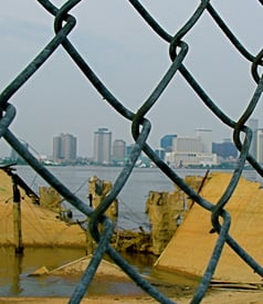
Over one million people in the Gulf area were affected by “the storm,” as residents call it, including just about everyone in New Orleans. Ninety percent of this 485,000-person city evacuated as 125,000 homes were severely damaged and 250,000 homes were summarily destroyed.
“The 150 mph winds from the east funneled water into the man-made navigation canals and the Category 5 surge strength made the levees breach starting with the 17th Street Canal of the Industrial Canal,” said Richard Campanella, associate director of Tulane University’s Center for Bioenvironmental Research and a research professor with Tulane’s Department of Earth and Environmental Science. “Sixteen feet of water poured into an area that was four feet below sea level. That caused a flood of 20 feet in St. Bernard Parish and the Lower 9th Ward. This area had been developed after Hurricane Betsy [of 1965].”
“There was no electricity and the city was empty, with no sound, no birds and in complete darkness,” said Sen. Mary Landrieu (D-Louisiana), relating her feelings a few days after the storm as she looked over the city from a high bridge. The born and bred Orleanian and former mayor found Katrina’s damage to be an unbelievable “out of body experience.”
They both spoke at the annual conference of the American Planning Association (APA) recently, which focused on the effects of Katrina and the recovery effort.
“Topography does matter,” said Campanella, who pointed out that sea level increased by four inches during the 20th century and predicted that in another 100 years they will rise another 41 inches, mostly due to climate change. (The US Global Change Research Program reports that by 2100 global sea level is projected to rise 19 inches along most of the US coastline.)
While the US Army Corps of Engineers is usually fingered as the culprit of Katrina flooding, responsibility really rests squarely on the shoulders of all those who believe they can control the Mississippi River and make the land something it is not. Actually, that includes just about everyone: the US Congress that funds water projects, business and industry that demand these projects and Americans who benefit or depend on the commerce conducted on the river.
The “Big Muddy”
The Mississippi River remains a key influence on life in the Crescent City. It stretches 2,320 miles from Lake Itasca, Minnesota, to the Gulf of Mexico, just 95 river miles south of New Orleans. The “Big Muddy” is the largest river system in North America and it includes all or parts of 31 states from the Rocky Mountains in the west to the Appalachian Mountains in the east to the US-Canadian border in the north.
Every spring, for thousand of years, the river’s banks have overflowed as million of tons of sand, silt and clay sediments settled and nourished wetlands and formed the delta coastline of southern Louisiana. Traditionally, the river and its distributaries were able to compensate for subsidence with fresh sediment spread in floods and decayed vegetation that turned into soil. That all changed when Congress decided it could tame the river.
Before cities were built, native peoples merely moved their stuff to higher and dryer ground when the floods came, and they continued with their lives, according to John McPhee in his book, “The Control of Nature.” In the 19th century, Congress funded the building of levees to hold back the floodwaters and several drainage projects in the wetlands as means of preventing disease and encouraging economic development. While this strategy has reaped hefty rewards for the farmers and industrialists who took advantage of the river’s navigational assets, it reveals the folly of the unremitting determination to control nature.
The Army Corps of Engineers had been stationed in the area since the War of 1812, so it was asked to continue its presence. When Congress created the Mississippi River Commission in 1879, it assigned the Corps the job of “prevent[ing] destructive floods.” The Corps took its orders seriously and for the next 125 years it built levees, gates, dams and reservoirs, spillways, floodways and cutoffs. These efforts minimized the flooding, except in some exceptional years like 1973 and 1980, but the sea waters of the Gulf remained an ever-encroaching threat because of all the disruptions to the natural processes of the river.
The 20th century brought more federalized river control and levee construction as New Orleans became a modern city with a downtown, streetcar networks, electricity, skyscrapers, a municipal water treatment plant and sewage system as well as a world-class drainage system.
In 1950 the US Congress ordered the Corps to maintain the “latitude flow” of the river at 30 percent in perpetuity. While this order makes sense to promote stability of cities and industries that lie between Baton Rouge and New Orleans, known as the “German coast” or the “American Ruhr,” the Mississippi River had other ideas, namely, to change course.
Actually, the Mississippi River changes course at its Gulf outlet once every 1,000 years. Currently, it has sought to divert more of its flow to the Atchafalaya River, a distributary of the Mississippi and Red Rivers, into the Atchafalaya Basin, the largest swamp in the United States. The Atchafalaya River is approximately 170 miles long and 60 miles west of New Orleans. A change of course would bypass river cities like New Orleans, Baton Rouge, Vicksburg, Natchez.
To solve this problem, the Corps built the Old River Control Structure in the 1940s where its floodgates could be opened and closed as needed. A film that showcased this project reveals the Corps’ confident “macho” approach toward its mission to save the economy from nature, its declared enemy.
Between 1950 and 1973, the “intensification of land use in the lower Mississippi” occurred through suburbanization, agriculture and the gas and oil industry, which helped make New Orleans a lot harder to protect against storms and the floods. In New Orleans, which is as much as 15 feet below sea level, two percent is terra firma, 18 percent wetland and 80 percent water, according to McPhee.
As the city grew larger, it began to sink and, by 2000, it was six to eight feet below sea level, thus, creating “the bowl” that Hurricane Katrina so catastrophically filled. The natural flooding and drainage of the Mississippi River had been ignored in favor of creating a canal and pumping system. And although Hurricane Betsy sounded the alarm in 1965 that this system literally rested on shaky ground, the water control projects continued.
For example, in 1960, the metropolitan area occupied 100 square miles with 630,000 residents. In 2005, it occupied 180 square miles with a population of 480,000. It didn’t help that one-story suburban ranch houses built on concrete slabs in the most vulnerable areas had replaced the traditional shotgun houses that were raised off the ground. Today, less than 350,000 people live in the city after 90 percent of them evacuated because of Katrina.
Meanwhile, over the past 60 years, the oil and gas companies have built 8,000 miles of canals in the wetlands. These canals were dredged up to six or seven feet deep and 15- to 25-foot wide to accommodate the transportation of drilling rigs. However, a typical canal would double its width in five years through wetlands erosion.
“The rise of the petroleum industry and the building of new canals had all sorts of ecological impacts, including increased saltwater intrusion and continuing erosion of the wetlands,” said Campanella.
The delta region is comprised of wetlands that supports a vast diversity of wildlife and that protects people from storm surges. The wetlands have been eroding at the rate of about 25 square miles annually or about one football field every day. Katrina’s storm surge broke levees in 53 places and caused the flooding of New Orleans, and many people are concerned about the dangers ahead for the region.
“The coast is sinking out of sight,” said Oliver Houck, professor of environmental law at Tulane University. “We’ve reversed Mother Nature.”
“By 2050, the city will be closer to and more exposed to the Gulf of Mexico,” noted the authors of “Coast 2050: Toward a Sustainable Coastal Louisiana,” a 1998 restoration plan put together by the State of Louisiana and the federal government.
Hurricane Katrina helped step up coastal erosion like the Chandeleur Islands, a 40-mile-long series of uninhabited barrier islands southeast of New Orleans. The storm took five meters of sand and marsh and left only half a meter, according to Gregory W. Stone, a coastal geologist at Louisiana State University.
“Wetlands and barrier islands are the first line of defense [against storms]. That means areas such as New Orleans would become more vulnerable to inundation,” said Stone.
Restoration of the Wetlands
For the past 20 years, many efforts have aimed at restoring the wetlands, but they require a lot of money and time and still depend on technological fixes that attempt to control Mother Nature.
For example, in 1990 Congress passed the Coastal Wetlands Planning, Protection, and Restoration Act to rebuild the state’s natural infrastructure with 118 projects at $50 million per year. Appropriations were extended until September 2009.
“Coast 2050” suggested that the Corps imitate the Mississippi River’s natural processes by diverting freshwater into the delta through pipelines and canals and push back saltwater intrusion from the Gulf. Also proposed was the dredging of soils and ancient sandbars to create new marshlands and shore up barrier islands as a defense against storms at a cost of $14 billion.
Kerry St. Pé, director of the Barataria-Terrebonne National Estuary Program, has proposed that dredge material and sediments also be pumped through canals and pipelines to rebuild declining wetlands.
The 2005 Water resources Development Act provided $1.9 billion in federal money over ten years for restoration of the delta.
Other ideas include allowing the Mississippi River to change course at its Gulf outlet in order to rebuild the western wetlands.
In 2005, Senator Landrieu has proposed the Hurricane Katrina Disaster Relief and Economic Recovery Act to provide $250 billion for hurricane reconstruction with $40 billion for ecosystem restoration and levee improvement. Although she has brought in some relief monies, she has been unable to get this act passed.
Land loss in southern Louisiana, as many experts say, is not a local problem – it’s a national problem.
Join us in defending the truth before it’s too late
The future of independent journalism is uncertain, and the consequences of losing it are too grave to ignore. To ensure Truthout remains safe, strong, and free, we need to raise $46,000 in the next 7 days. Every dollar raised goes directly toward the costs of producing news you can trust.
Please give what you can — because by supporting us with a tax-deductible donation, you’re not just preserving a source of news, you’re helping to safeguard what’s left of our democracy.